The 9-day outlook reveals where temperatures will be above and below normal – Severe weather coming on Thur/Fri – 2 Atlantic systems to become hurricanes on Wednesday – Today’s weather alerts
NWS weather alerts for Wednesday
Here are Wednesday’s weather alerts from the National Weather Service (NWS).
Winter storm warning: northwestern Montana; northeastern and east-central California; southwestern Utah; southwestern Colorado.
Winter weather advisory: north-eastern, east-central, southwestern California; southwestern Oregon; northern Idaho; northwestern and southeastern Montana; north-central central and southern Wyoming; western Colorado; Utah; eastern Nevada; northeastern Arizona; north-central New Mexico.
High wind warnings and advisories for portions of Montana, Idaho, Wyoming, North Dakota, South Dakota, Colorado, Kansas, southern California, and northern Arizona.
Red flag warning for portions of North Dakota, South Dakota, Wyoming, Nebraska, Colorado, and Kansas.
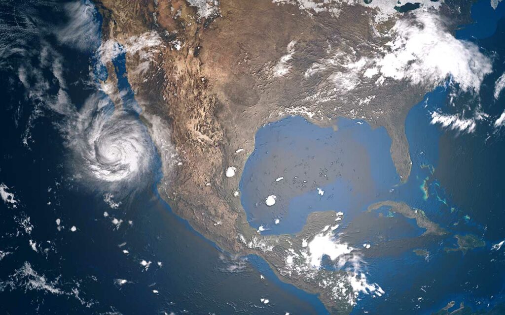
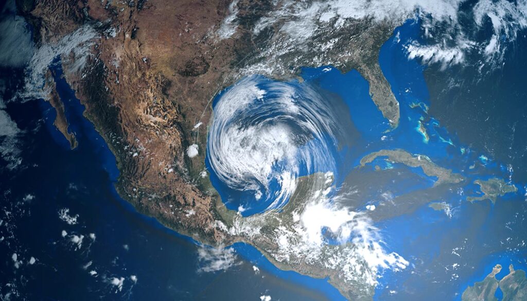
2 Atlantic systems to become hurricanes, 1 to make landfall on Wednesday
Tropical storm Lisa is now Hurricane Lisa in the Caribbean and Tropical Storm Martin in the northern Atlantic is expected to reach hurricane strength sometime on Wednesday, WFLA reported.
As of 7 AM CDT on Wednesday, Hurricane Lisa had sustained winds of 75 mph and was moving west at 15 mph, according to the National Hurricane Center (NHC). Tropical storm Martin had sustained winds of 65 mph and is traveling east-northeast at 15 mph. Lisa is expected to make landfall in Belize early on Wednesday afternoon as a Category 1 hurricane with winds of 85 mph.
“Disturbance 1” in the southwestern Atlantic had a 20% chance of cycle and formation in the next 5 days. Forecasters are watching this system which could strengthen over the weekend and into next week and potentially make its way back to the southeast United States, WFTV in Belize reported.
9-day weather outlook and Wednesday’s forecast
The Climate Prediction Center issued its 9-day forecast for November 2-6, 2022, which shows below-normal temperatures in the West, particularly for California and Nevada. The central US and the South will have above-normal temperatures, with much above-normal temperatures for the northern regions of the south and southeast, Midsouth, eastern Midwest, Great Lakes region, Ohio Valley, mid-Atlantic, and Northeast, WGNTV reports.
Weather forecast for Wednesday
Here is Wednesday’s forecast from the National Weather Service (NWS).
Mixed precipitation over most of the Western US for all states east of Texas. Snow over parts of Idaho, Montana, California, Nevada, Utah, New Mexico, Colorado, and Wyoming.
Potential heavy snow over portions of northern Idaho, northwestern Montana, western Wyoming, northeastern and west-central Utah, east-central Nevada, and east-central California.
Thunderstorms over southern and southeastern Texas along the Gulf into southwestern Louisiana, as well as over most of Florida, and along the central and northern North Carolina coast.
Severe weather on Thursday and Friday in central US
Unseasonably warm air in the Midwest will clash with a cold front moving from the West to bring severe weather on Thursday. The Storm Prediction Center (SPC) has issued a Level 2 severe weather alert on Thursday for northern Texas, western Oklahoma, and from south to north through central Kansas into south-central and southwestern Nebraska.
A Level 2 severe weather risk has also been issued for Friday over central and eastern Texas into southern and central Oklahoma.
The NWS is warning of potential heavy rain with flash flooding over eastern Texas, northwestern Louisiana, and eastern Oklahoma into western and central Arkansas.