Severe storm threat in central US over next two days – Strong weekend weather coming across US over the weekend – Two new disturbances in Atlantic could impact the US – Today’s alerts and the weekend forecast
NWS weather alerts for Thursday
Here are Thursday’s weather alerts from the National Weather Service (NWS).
Winter storm warning: southwestern Utah; southwestern Colorado.
Winter weather advisory: northwestern Washington, southwestern Montana; Wyoming; Utah; western Colorado; east-central and southwestern Nevada; southern California; northeastern Arizona; northwestern and north-central New Mexico.
High wind warnings and advisories for portions of Montana, Wyoming, Nebraska, Washington, Oregon, southern California; New Mexico, and extreme western Texas.
Severe storm threat next two days in central US, South
A strong severe weather risk over the central US and South on Thursday and Friday, with an increasing threat of tornadoes as an early winter blast will meet record autumn warmth over the next few days, CNN reported.
On Thursday, The Storm Prediction Center (SPC) issued a Level 2 severe weather risk over northern Texas into western Oklahoma, and South-Central and central Kansas.
For Friday, the threat will increase significantly and will be more widespread. The SPC has issued a Level 3 severe weather risk over eastern Texas into southeast Oklahoma, southwestern Arkansas, and northwestern Louisiana, as well as a Level 2 severe weather risk over central and eastern Texas; central and eastern Oklahoma; southwestern Missouri; western and central Arkansas, and western and central Louisiana.
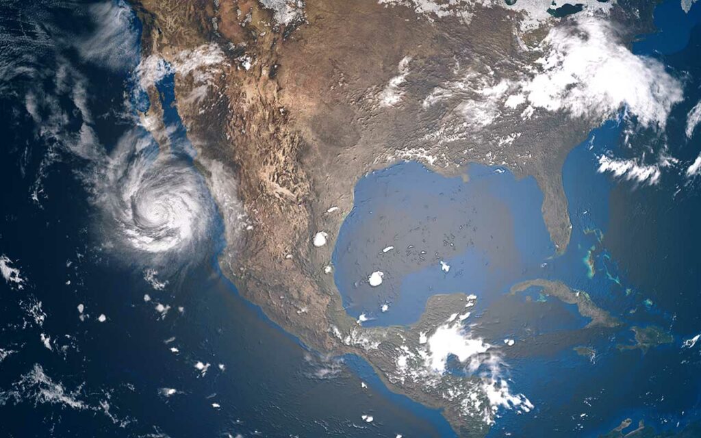
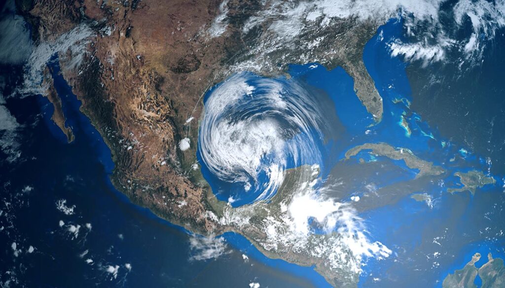
Hurricane forecast: 2 new systems could impact US
In addition to Tropical Depression Lisa over Central America, and Hurricane Martin in the northeastern Atlantic, two new disturbances are active in the Atlantic that have the potential to develop next week, WFTV reported.
“Disturbance 1” in the northwestern Atlantic a few miles east of Bermuda has a 10 percent chance of cycling development over the next 5 days. “Disturbance 2” in the southwestern Atlantic has a 30 percent chance of cyclone development in the next five days. This system is expected to develop this weekend over the northeastern Caribbean Sea, according to the National Hurricane Center (NHC), and could potentially move toward Florida, Georgia, or the Carolinas next week.
Weekend forecast: Atmospheric river, heavy snow, flooding, and severe thunderstorms
A wide variety of strong weather across the US through the weekend will bring heavy snow, flooding rain, severe weather, and potential tornadoes from the West to the east.
Here is the forecast for Thursday through the weekend from the National Weather Service (NWS).
Thursday: Severe weather, heavy snow, thunderstorms
Wintry weather in the West will bring mixed precipitation from California to the Great Lakes region.
Heavy snow over portions of Washington, Oregon, Idaho, Montana, Wyoming, Utah, and Colorado, with snow also forecast over California, Nevada, Arizona, New Mexico, the Dakotas, and northwestern Kansas.
Severe weather for the central US over Texas, Oklahoma, and Kansas.
Thunderstorms are expected to bring soaking rain through the central US from Texas to the upper Midwest and Great Lakes region. Thunderstorms also for southern Florida and along the North Carolina coastal areas.
Friday: Northwest flooding, severe weather in central US and South
An atmospheric river in the Northwest will deliver heavy rain and potential flooding over portions of Washington and Oregon.
Heavy snow over parts of Washington, Oregon, Idaho, and Montana, with snow over Wyoming, Utah, Colorado, and New Mexico.
Severe weather in the central US and South over Texas, Oklahoma, Louisiana, Arkansas, and Missouri.
Thunderstorms will stretch from the Gulf to the Great Lakes over parts of the Midwest, South, and Ohio Valley.
Rain in the southeast over portions of Georgia, the Carolinas, Tennessee, and the Virginias.
Saturday: Snow in the West, rain, and thunderstorms in the East
Mixed precipitation for most of the northern areas of the West, with heavy snow over portions of Washington, Idaho, Montana, and Wyoming.
rain and thunderstorms for much of the east over the South, Southeast, Great Lakes region, Ohio Valley, and Atlantic, and parts of the Northeast.
Sunday: Heavy rain and snow in the Northwest, rain in the East
Heavy rain with potential flooding in the Northwest, as well as heavy snow possible over Washington, Oregon, and Northern California, with snow also over Idaho, Montana, and Wyoming, as well as veering into portions of South Dakota, Nevada, Utah, and Colorado.
Rain in the east over parts of the South, Southeast, mid-South, mid-Atlantic, and Northeast.