On the first official day of fall, a significant threat of a hurricane in the Gulf has arisen. Hurricane Fiona is now a Category 4 and will impact East Coast. All this and more weather news, today’s alerts, and the weekend forecast.
First day of fall, today’s NWS weather alerts
The first day of fall in the US, officially known as the autumn equinox, begins at 9 PM ET on Thursday. The equinox marks a day when the Earth tilts neither toward or away from the sun, giving the planet nearly an equal amount of daylight and darkness, NPR reported.
NWS weather alerts for Thursday
Here are today’s weather alerts from the National Weather Service (NWS).
Flood watch: eastern Utah, western and central Colorado, central and northeastern Arizona, northwestern New Mexico.
High wind warning: southeastern Wyoming.
Wind advisory: southeastern Idaho; northeastern Montana; southwestern North Dakota; northwestern South Dakota; north-central, central, and southeastern South Dakota; east-central Georgia.
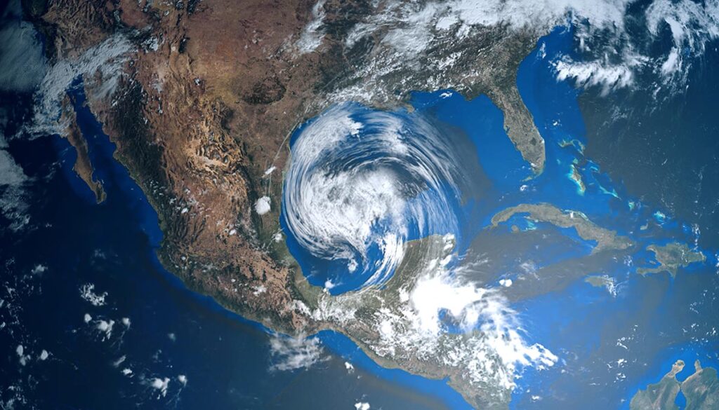
Hurricane Fiona strengthens, to impact East Coast surf
Hurricane Fiona has strengthened to a Category 4 storm and is bearing down on Bermuda, where it is expected to remain a dangerous and major storm though decreasing to a Category 3, ABC reported. Fiona is expected to make landfall in Nova Scotia, Canada, on Saturday as a category 1 or 2.
Fiona’s impact on US
While hurricane Fiona will steer well clear of the US mainland, the storm will still have an impact on the East Coast. Wave heights will increase this week, which can affect both swimmers and boaters, as the greatest threat will be from rip currents later this week and weekend, the Weather Channel reported.
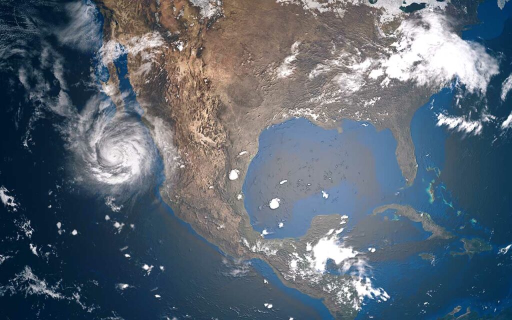
Significant threat of a hurricane in the Gulf of Mexico next week
Forecasters believe “Disturbance 1 or Invest 98L,” currently churning off the northeastern coast of South America, will develop into a hurricane next week. The storm is expected to bring the most significant threat thus far of the Atlantic season of moving into the US Gulf, USA Today reported. Forecasters from the National Hurricane Center (NHC) currently give the storm a 90% chance of developing into a cyclone in the next five days.
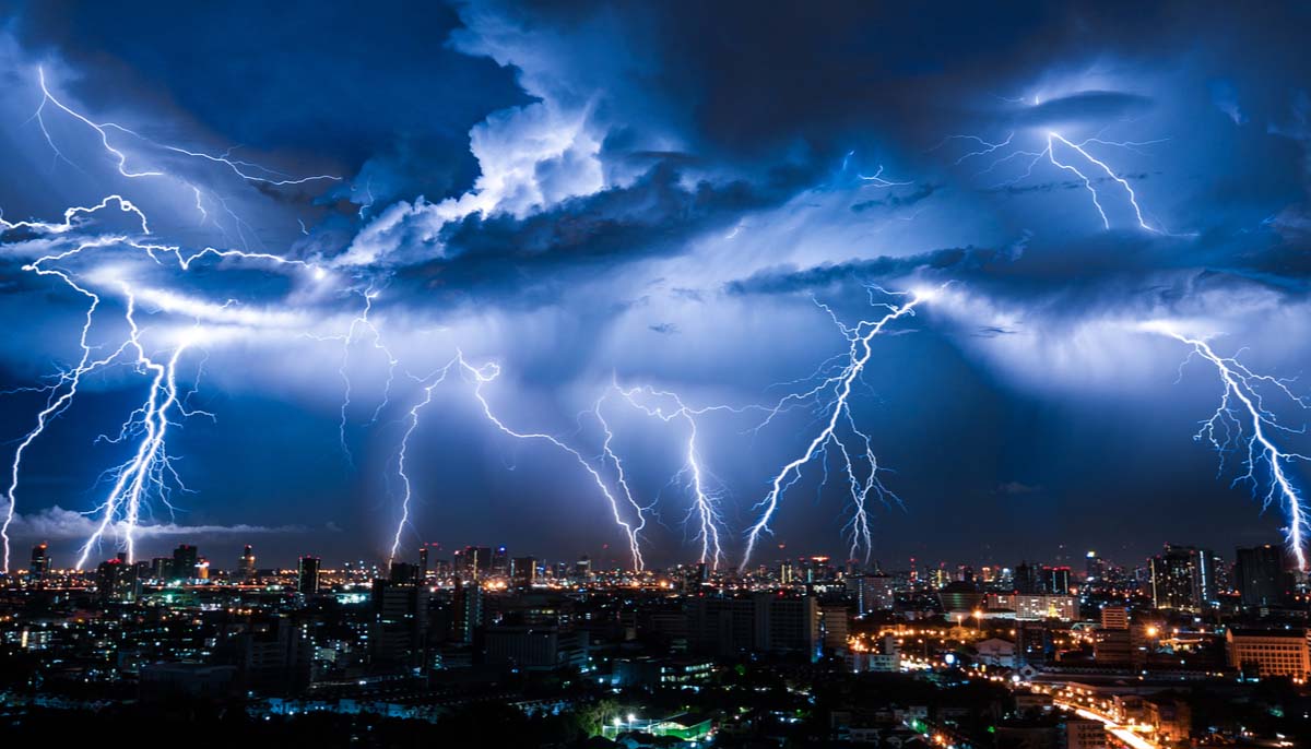
The weekend forecast: Thunderstorms gradually decrease
Weather conditions will improve as we progress into the weekend, with significantly fewer thunderstorms by Saturday. The entire East Coast will see dangerous surf due to the impact of hurricane Fiona in the Atlantic.
Here is today’s weather and the latest weekend forecast from the National Weather Service (NWS).
Thursday: Abundant thunderstorms, rain; flooding risk in West
Thunderstorms in the West, central US, and all along the East Coast. Rain for the Northwest, Midwest, mid-South, and mid-Atlantic.
Heavy rain will bring the potential of flash flooding over northern Idaho, western Montana, southeastern Utah, western and central Colorado, northeastern and south-central Arizona, and northwestern and north-central New Mexico.
Friday: Fewer thunderstorms, still raining
Thunderstorms in southeastern California, most of Arizona, and into western, central, and northern New Mexico, crossing into northern Texas and extreme western Oklahoma. Thunderstorms also over the upper Midwest, and another band of thunderstorms along the Gulf, plus over much of Florida.
Rain for the Midwest and parts of the Ohio Valley over Minnesota, Wisconsin, Iowa, Kansas, Missouri, Illinois, Indiana, and Kentucky. Mostly dry for the South, Southeast, mid-Atlantic, and Northeast.
Saturday: Decreasing thunderstorms
Clear conditions for most of the US. Thunderstorms in the Southwest over southern Arizona and New Mexico. In the East, scattered thunderstorms over portions of Minnesota, Wisconsin, Michigan, Illinois, Indiana, Ohio, Pennsylvania, West Virginia, Kentucky, Missouri, Oklahoma, Texas, Arkansas, Louisiana, Mississippi, Alabama, Georgia, and Tennessee, as well as over central and southern Florida.
Sunday: Rain returns to the east
Most of the western and the central US is expected to be dry, but east of the Mississippi chances of thunderstorms and rain increase for the Great Lakes region, Ohio Valley, and parts of the mid-Atlantic. A lesser chance of thunderstorms and rain for parts of the South. Thunderstorms over central and south Florida.