Ian strengthened into a Category 1 hurricane and is expected to grow even stronger soon. All of Florida is preparing for impact midweek–here’s what you need to do. Today’s weather alerts, forecasts, and news.
NWS weather alerts for Monday
Here are the latest weather alerts for Monday from the National Weather Service (NWS).
Excessive heat warning: southern California.
Heat advisory: southern California.
Red flag warning: western Washington.
Tropical storm warning: southern Florida.
Hurricane watch: Tampa, Florida.
Tropical storm watch: central and southern Florida.
High surf advisory: western Florida coast.
Monday’s forecast
Thunderstorms for the Southwest, South, Southeast, upper Midwest, mid-Atlantic, and Northeast.
In the Southwest, thunderstorms over central and eastern Arizona, western and central New Mexico, and into southern Colorado. Thunderstorms along the southern Texas border and the eastern Gulf, stretching along the southern Gulf states, over all of Florida, southern Georgia, and along the eastern coast of the Carolinas.
Thunderstorms in the Midwest over parts of Minnesota, Wisconsin, and Michigan, into the Ohio Valley over parts of Indiana, Ohio, and West Virginia, and throughout the entirety of the mid-Atlantic and Northeast.
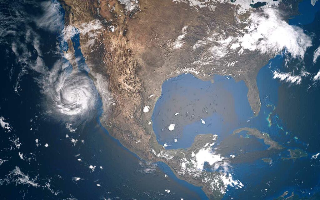
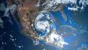
Ian strengthens to Category 1 hurricane, headed for Cuba and Florida
Ian strengthened to a Category 1 hurricane on early Monday and as of 11 AM EDT had sustained winds of 80 mph. and The storm is located in the Caribbean south of Western Cuba, according to the National Hurricane Center(NHC).
The NHC said the storm is expected to rapidly strengthen during the next day or so and become a major hurricane as it nears Western Cuba, late Monday into early Tuesday, NBC reported.
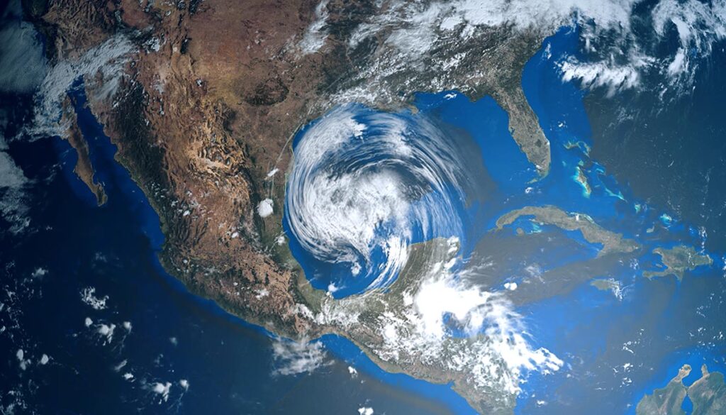
Florida impacts to be felt starting Tuesday, major impacts Wednesday-Thursday
As Ian approaches, impacts from the storm will begin to be felt in central and southern Florida on Tuesday with heavy rain that could lead to flash flooding, as well as severe weather along the western coast from Tampa to the southern tip.
Forecast track
The current forecast track shows the storm nearing Tampa late Wednesday as a major hurricane and making landfall near or north of the city between late Wednesday and late Thursday. If the storm arrives by late Thursday, it is expected to lose its “major” hurricane status. The track also shows the storm over south-central Georgia as a tropical storm by late Friday.
Another system active in the Atlantic
On Monday, “disturbance 1” was active in the central tropical Atlantic with a 70 percent chance of cycle information in the next five days, according to the NHC. The system was located several hundred miles west of the Cabo Verde Islands.
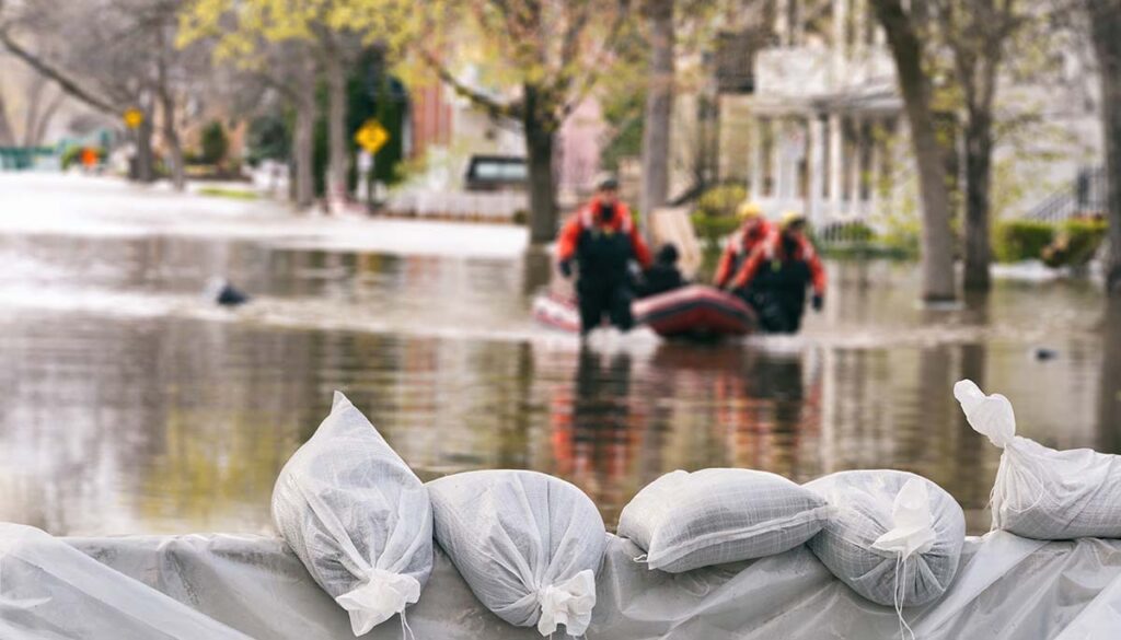
How to prep for a hurricane
Here are some tips for getting prepared for hurricane approaches. Make sure you have backpacks and/or sturdy travel bags to carry the items below!
Days before the storm, make sure you have all of the following:
-A battery-powered radio; an NOAA radio is even better.
-Extra batteries.
-A first aid kit.
-Toilet paper.
-Flashlights
-Sleeping bags and blankets.
-A 3-day supply of food and water for each person and pet. One gallon of water per person per day.
-A weeklong supply of prescription medicines.
-Non-perishable and canned foods, plus a can opener.
-A barbecue or other cooking method not dependent on city electrical or gas supplies.
-Disposable and/or non-breakable cups, paper plates, paper towels, eating utensils, and cooking utensils.
-Garbage bags.
-Household bleach, soap, disinfectant, feminine supplies, wet wipes.
-Rain gear and sturdy shoes.
-A fire extinguisher.
-A backup battery charger for cell phones.
-Cash.
-Plastic bucket with a tight lid.
-Roadside emergency kit.
-Jumper cables.