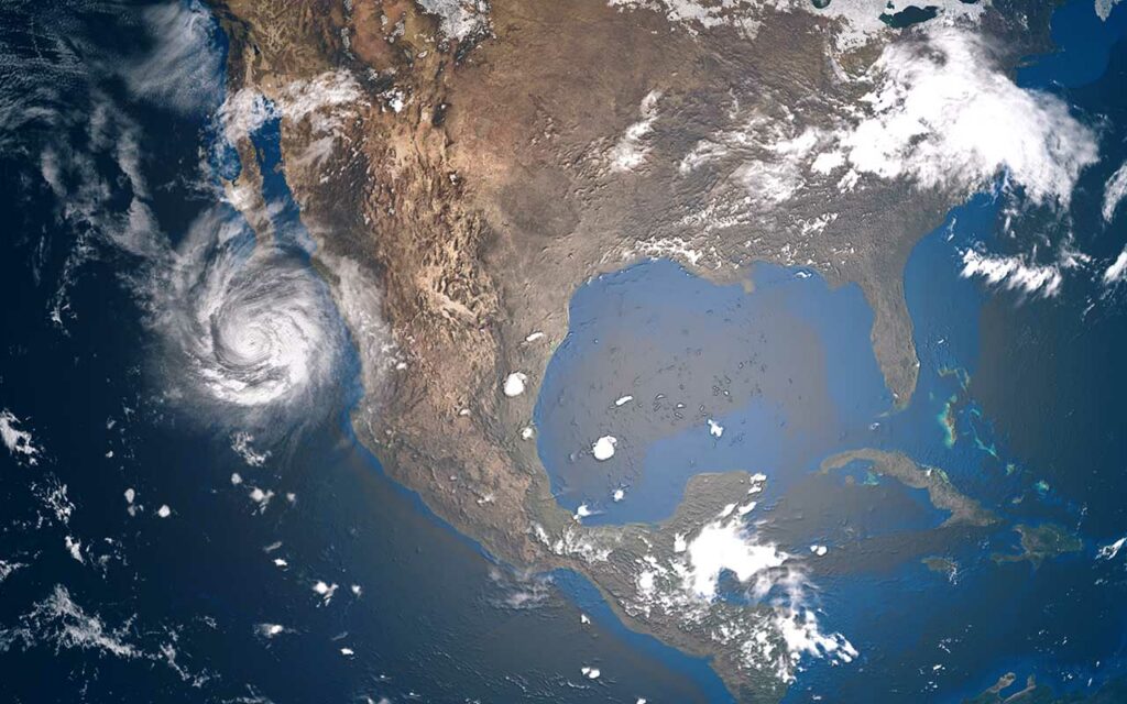
In 2012, Hurricane Sandy carved a destructive path from the Caribbean up into Canada. At its peak, the storm measured 1,150 miles wide, making it the largest Atlantic storm ever by diameter. Sandy was the deadliest tropical storm of the 2012 Atlantic hurricane season, claiming 233 lives before dissipating over Canada.
The storm’s size and slow movement made it particularly devastating. In a rare occurrence, the storm impacted every US state along the eastern seaboard, from Florida up to Maine. Some of the worst damage inflicted by the storm concentrated in the Northeast, with catastrophic flooding in New York and New Jersey. Seventy-one people in the US died as a direct result of the hurricane. Tragically, most of these deaths occurred in New York due to flooding.
History and Formation
Sandy formed on October 22, 2012, from a low-pressure system south of Jamaica. It grew swiftly, owing to favorable Caribbean conditions. Low wind shear and unseasonably warm waters fed the tropical depression the fuel it needed. The tropical front moved at a glacial pace after its initial formation due to the calm, still winds near Jamaica at the time. By the end of the day on October 22, the system became the eighteenth named tropical storm of 2012.
Two days later, on October 24, the tropical storm developed an eye and began moving northward through the Caribbean. At this point, the National Hurricane Center confirmed that the pattern had become a hurricane, with sustained wind speeds exceeding 85 miles per hour. It made its first landfall on Kingston, Jamaica, that same day.
As the storm continued north, it grew to a record-setting diameter. By October 29, the hurricane had a central barometric pressure of just 940 bar, owing to its bizarre size. Sandy is responsible for bringing about some of the lowest atmospheric pressures ever observed in New England.
Forecasts of “Frankenstorm”
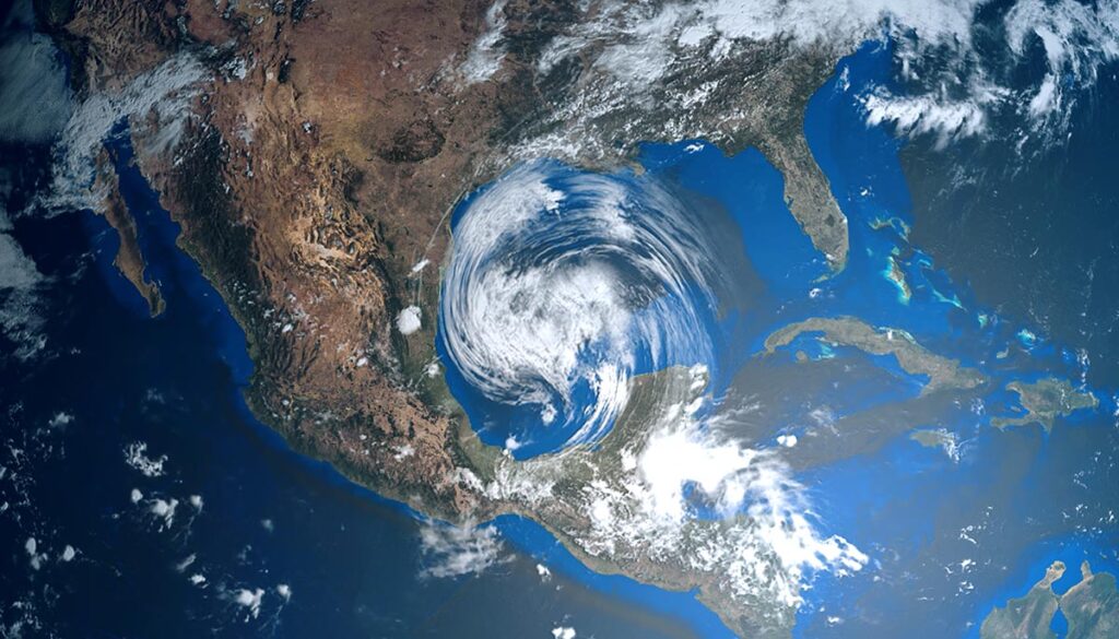
The days before Sandy’s arrival in the US were marked by fears of a “Frankenstorm”. The hurricane occurred late in the season and pushed very far north. This northward push could have triggered a Fujiwhara Effect, a meteorological phenomenon where a tropical front merges with a winter storm to become a dangerous hybrid weather system.
Across the East Coast, states scrambled to make preparations ahead of the hurricane’s arrival. By the time Sandy made landfall near Brigantine, New Jersey, on October 29, it had already lashed the eastern seaboard with torrential rain and surging tides.
Impact in Northeast
The tropical front’s legacy in the US solidified due to its devastating impact on New York and New Jersey. Sandy brought a wall of storm surge waves with it into the Northeast, flooding much of the city of Hoboken and causing thousands of people to evacuate. Meanwhile, New York City experienced historic floodwaters, with the East River jumping its banks and soaking Lower Manhattan.
The New York subway system was devastated by Sandy, with seven tunnels under the East River flooding completely. Homes throughout Queens, Brooklyn, and Staten Island were damaged or destroyed by the Atlantic storm surge.
By the time Hurricane Sandy finally dissipated over Canada, it had caused $65 billion in damage in the US alone. That ties the storm with Ida for the fourth most-expensive Atlantic hurricane in American history. Meteorologists in 2016 reported that Sandy was the most devastating hurricane to impact New York since 1700.