Officials say it’s “too late to get out” for people who didn’t heed coastal evacuation orders as Hurricane Ian bears down on Florida. The storm has developed 155 mph winds, which puts it just shy of Category 5 strength. See your weather news, updates, and alerts.
NWS weather alerts for Wednesday
Here are Wednesday’s weather alerts from the National Weather Service (NWS), affecting people coast-to-coast.
Hurricane warning: Florida.
Tropical storm warning: Florida, southeastern Georgia, southeastern South Carolina.
Tropical storm watch: northern Florida, southeastern Georgia, southeastern South Carolina.
Storm surge warning: Coasts of Florida, Georgia, and South Carolina.
Gail warning: Coasts of North Carolina, Virginia, Maryland, Delaware.
Red flag alert: eastern and southeastern Louisiana, eastern Arkansas, Mississippi, Alabama, southwestern Tennessee, western Florida Panhandle, south-central and southeastern Wyoming, northeastern California, and northwestern Nevada.
Wind advisory: northwestern Nevada.
Freeze warning: northern Michigan.
Frost advisory: central and southwestern Michigan.
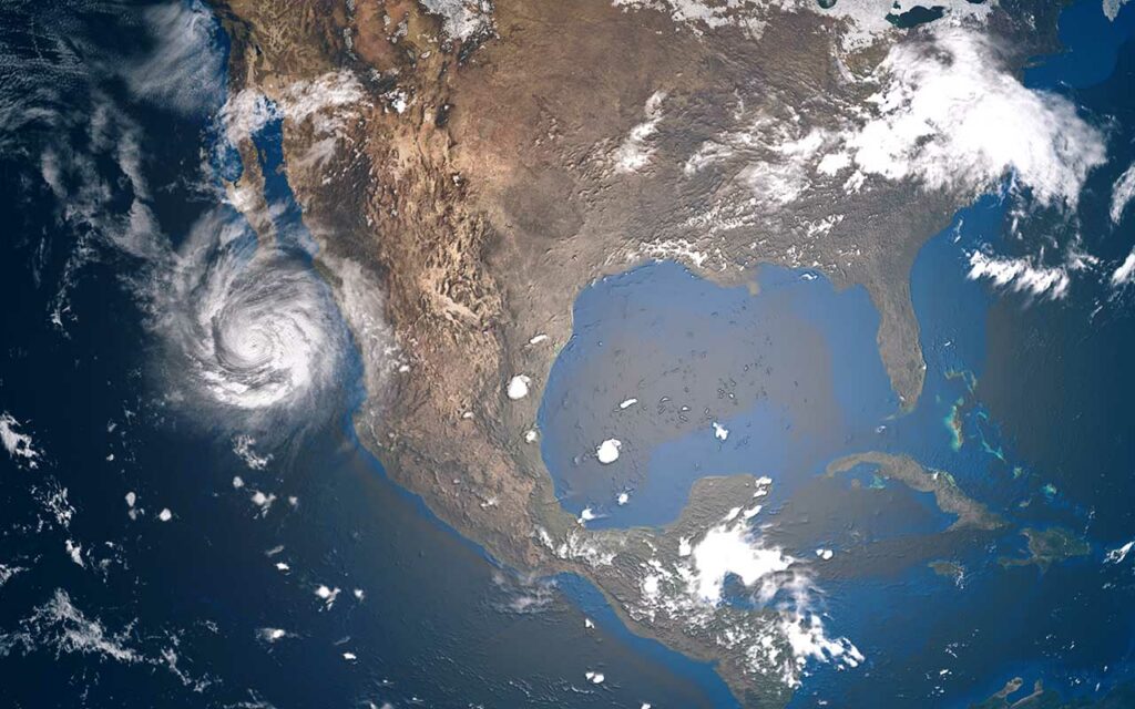
Hurricane Ian nearly category 5 as dangerous eyewall moves onshore in Florida
Packing winds of 155 mph, Hurricane Ian is just shy of Category 5 (157 mph) designation as the storm’s dangerous eyewall moves onshore in Florida, Fox reported. At 11 AM ET, the storm was located 45 miles west of Naples.
After passing over Cuba Tuesday, Ian left at least two dead and an islandwide blackout.
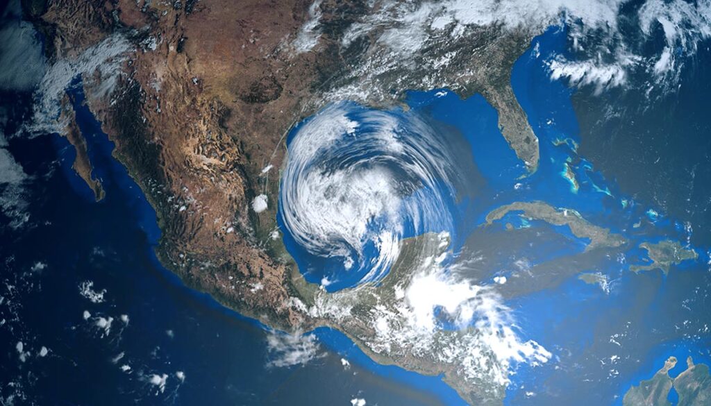
Major wind, rain, flooding, and storm search threats Florida, Georgia, and South Carolina
Florida is expected to see between 12-18 feet of seawater pushed onto land with storm surge, while sustained winds could exceed 150 mph, with gusts up to 190 mph, delivering “catastrophic wind damage,” according to the National Hurricane Center (NHC).
Flooding rain between 12 to 24 inches could potentially fall over central and northeastern Florida, as well as over Tampa, Orlando, and Jacksonville, presenting a major threat of flooding.
“Widespread, life-threatening catastrophic flash, urban, and river flooding is expected” across central and southern Florida, the NHC said.
Significant flooding is also possible in southeastern Georgia and coastal South Carolina through the weekend, according to the NHC.
Too late to safely evacuate in Florida, officials say
Local officials and those with the National Weather Service (NWS) said that people who have yet to evacuate no longer have a chance to do so. It’s simply too late to get out, CNN reported. NWS advised people to “move to upper floors to escape rising water if necessary.”
For those located in Collier County up to Sarasota County, “it’s no longer possible to safely evacuate,” Gov. Ron DeSantis said around 8 a.m., as key paths out are closing.
“It’s time to hunker down and prepare for this storm,” DeSantis said. “This is a powerful storm that should be treated like you would treat [an approaching tornado].”