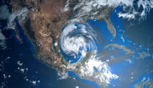
Hurricane Fiona has intensified into a Category 3 and could impact Maine as it passes by. Potential severe weather over the Great Lakes and possible flooding in the Southwest. See today’s weather alerts and forecast.
Fiona strengthens into a Category 3 hurricane
Hurricane Fiona strengthened to a major Category 3 storm on Tuesday as it moved past Puerto Rico and the Dominican Republic. The storm pounded the islands with up to 30 inches of rain, leaving behind catastrophic flooding and mudslides. Over 80% of Puerto Rico was without power on Tuesday, USA Today reported. The storm is expected to intensify further into a Category 4.
Fiona could impact Maine, will pass over Nova Scotia and Newfoundland
The latest trajectory shows Hurricane Fiona could impact parts of Maine and potentially New England late this week as it passes. The storm is projected to move north and north-northeast in the coming days, WMTW reported.
Fiona is forecast to pass directly over Nova Scotia and Newfoundland, maintaining hurricane-force wind. A CBC meteorologist said Fiona was expected to become a Category 4 hurricane over the next couple of days.
NWS weather alerts for Tuesday
Here are the latest weather alerts from the National Weather Service (NWS) for Tuesday.
Flash flood watch: north-central and east-central California.
Flood watch: central, southern and eastern Utah; western Colorado; central, north-central, and northeastern Arizona; west-central, northwestern, and central New Mexico.
Red flag alert: north-central Washington.
3-day forecast
Here is the latest three-day forecast from the National Weather Service (NWS).
Tuesday: Severe weather in upper Midwest, potential flooding in Southwest
The Storm Prediction Center (SPC) has issued a Level 2 severe weather risk for northern Michigan; northwestern, northern, and west-central Wisconsin; and east-central Minnesota. Strong storms are also possible in the surrounding areas of eastern Minnesota, throughout Wisconsin, and into western and central Michigan.
Heavy rain is forecast over the Southwest over parts of Utah, Colorado, Arizona, and New Mexico (see alerts above).
Scattered thunderstorms in the West, with rain over parts of Oregon, northern and central California, into western Nevada. Scattered thunderstorms also over parts of Nebraska, Kansas, Texas, Alabama, Georgia, Florida, North Carolina, Indiana, Ohio, Pennsylvania, and New York.
Rain over parts of most of the Northeast.
Wednesday: Severe weather in Northeast, flood risk in Southwest
The SPC has issued a Level 2 severe weather risk over portions of Ohio, Pennsylvania, and New York, a lesser risk for the surrounding areas from Kentucky and Indiana to Vermont.
Thunderstorms will stretch from coast-to-coast, encompassing much of the West, then extend across the midsection of the country, expanding to cover most of the Ohio Valley, mid-Atlantic, and Northeast. Thunderstorms are also possible over central and southern Florida.
Mixed precipitation is possible over California, Oregon, Idaho, Montana, Wyoming, and Utah.
Thursday: Mixed precipitation, thunderstorms, rain
Mixed precipitation in the West over portions of Oregon, Idaho, Montana, Wyoming, Utah, and Colorado, as well as parts of New York and New Hampshire.
Scattered thunderstorms over the eastern and northern portions of the West into the central US. Heavy rain could bring potential flash flooding to parts of Colorado, Utah, Arizona, and New Mexico.
Thunderstorms over parts of the Southeast and mid-Atlantic. Rain over portions of the Ohio Valley and throughout much of the mid-Atlantic and Northeast.


