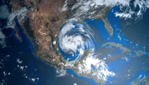
Strong storms over much of the US throughout the July 4 holiday weekend could put a damper on outdoor activities and fireworks. Severe weather is in the forecast on Friday and Saturday, so expect some travel disruptions.
NWS weather alerts for Friday, July 1
Here are the latest weather alerts by the National Weather Service (NWS) for Friday, July 1:
Flood watch: northern and central New Mexico; southeastern Texas; southwest Louisiana; coastal areas and the low country of South Carolina and Georgia.
Flood warning: northeastern Minnesota and northern Wisconsin; northern and northeastern South Dakota.
Severe thunderstorm warning: coastal areas of the western panhandle of Florida
Red flag warning: northern, northeastern, and southern Nevada; southeastern California, northwestern Arizona; eastern and central Utah.
July 4 Travel forecast: Where delays are possible
Friday, July 1: heavy rain could lead to travel disruptions in locations such as Houston, New Orleans, Atlanta, and Charleston. A medium chance of travel disruptions in Denver, Kansas City, Chicago, Cleveland, and Tampa.
Saturday, July 2: A high chance of travel disruptions in Kansas City, New Orleans, Washington, D.C., and at JFK in New York. Medium chance of delays in San Francisco, Nashville, Houston, and Tampa.
Sunday, July 3: A high chance of travel delays in Seattle, Missoula, New Orleans, Nashville, Raleigh, and Orlando. A medium chance of delays in Salt Lake City, St. Louis, and Atlanta.
Monday, July 4: A high chance of travel delays in Missoula, Minneapolis, Chicago, New Orleans, and Orlando. A medium possibility of delays in Seattle, Atlanta, and Raleigh.
July 4 holiday weekend forecast
Scattered thunderstorms will encompass most of the nation Friday through July 4 holiday on Monday. (fill in details on July 4 here).
Here is a look at the latest forecast from the NWS from Friday through Monday.
Friday, July 1:
Scattered thunderstorms from Utah eastward over nearly the entirety of the nation except for a gap over Minnesota, Wisconsin, and northern Michigan, as well as spots around Texas and Oklahoma, and northern Maine.
A Level 2 severe weather risk was issued by the Storm Prediction Center (SPC) over northeastern Wyoming into southwestern South Dakota and northeastern Nebraska.
Possible flash flooding over three separate regions: (1) southeastern Nebraska, northwestern Missouri, into north-central, central, and northeastern Kansas; (2) southeastern Texas into southwestern Louisiana; (3) along the Atlantic coast of southeastern Georgia into southeastern South Carolina.
Saturday, July 2:
Scattered thunderstorms over most of the nation.
A Level 2 severe weather risk was issued by the SPC over northern Virginia into Maryland and Delaware, southeastern and eastern Pennsylvania, Western, Central and Northern New Jersey, southern New York, Rhode Island, Connecticut, and Massachusetts.
Potential flash flooding over northeastern Kansas into northwestern, west-central, and central Missouri.
Sunday, July 3:
Scattered thunderstorms for most of the nation except for southern latitudes of the far West, portions of the Ohio Valley, the Mid-Atlantic, and the Northeast.
A large area of heavy rain in the upper Midwest could bring possible flash flooding over southern and southeastern, South Dakota, north-central, central and eastern Nebraska into western Iowa.
Critical fire weather is possible over central, southern, and eastern Nevada into western Utah.
Monday, July 4:
Scattered thunderstorms will be over the northern latitudes of the nation from west to east, as well as over the Great Lakes region, Ohio Valley, South, Southeast, and Mid-Atlantic. The South will see the most moisture on July 4, according to CNN. Possible thunderstorms for parts of the Southwest and Rockies. A reprieve from thunderstorms for most of the West and the central Plains.


